

Smart GIS GPS Software

وصف لـSmart GIS GPS Software
First African Arabian Egyptian GIS GPS Software by Africa Arab Egypt GIS Company Elshayal Smart GIS
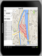
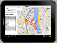
Elshayal Smart GIS is the First African Arabian Egyptian GIS GPS Software that is completely developed by Africa Arab Egypt GIS programmers and independent of any commercial package. It is not funded by any organization, and it consists of: 1) Map Editor and analysis for desktop, 2) Map Server for web, 3) Mobile GPS Tracking and Data Collector for mobile, 4) Download Rectified Google Earth, 5) Open Source to Convert GIS Shape Files to HTML Google Map Web GIS and Mobile App. Made in Egypt
Free Download https://drive.google.com/file/d/0B2qR4wxKKE_VUmR6V2hYRHRqb2c/view?usp=sharing
"This app collects location data to enable [Tracking], & [Infrastructures viewing] even when the app is closed or not in use.”


